Drain Charting & Mapping
The simplest of drain surveys is a basic mapping and charting exercise if you are supplying details on the system construction along with a site plan showing the lay out and outfall of the system.
The term Charting and Mapping however lends itself to larger site surveys where the layout and extent of a drainage system is largely or completely unknown, these could be industrial sites, hospitals, schools or sites that are to be developed or the existing system is to be modified or adapted in some way.
Drain Charting & Mapping Techniques
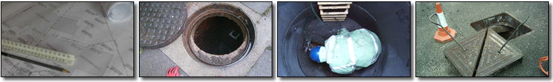
The simplest form of mapping a system is by lifting manhole covers and undertaking dye testing to confirm connectivity, pretty basic and results are obviously limited to the available access you have into the system.
Sonar drain tracing is used to find the exact line of a drain run which is useful when manholes are limited and particularly useful when you need to know where and how the system leaves the site, you can also calculate the depth of a drainage run with sonar equipment which then gives you the opportunity to the calculate falls if required.
If however you are looking for a full structural report and information on defects, pipe construction and all incoming connections you will need a drain camera inspection, this will also identify concealed chambers, tanks, ground water issues and potential points of water loss from the system.
In most cases we use all these techniques at some stage and it is often necessary to clean the system to some degree either prior too or during the survey works.
Drain Charting & Mapping Information
A full and detailed survey will offer up the following information in a digital format along with marked up site plans, data sheets and a written report detailing any defects.
- The layout of the drainage system(s) within the site itself
- Confirmation of the drainage system(s) outfall
- Pipe sizes, depth, construction and use (foul, storm, combined, effluent etc.)
- Manhole reports detailing invert levels , construction, and connectivity
- Additional information on petrol interceptors, septic tanks, storage tanks etc.
Charting & Mapping Domestic Drainage Systems
Pre-purchase drain surveys are a charting and mapping exercise and when properties are extended it is a good idea to find where your drainage systems runs to both avoid any accidental damage and to have a point to drain your new extension rainwater or foul water connections into.
Charting & Mapping Industrial Drainage Systems
We survey and map industrial sites so that the site operators know what they have below ground and are in a position to implement a planned maintenance scheme, where the works process or trade effluent has the potential to damage the below ground drainage and or there is a risk of ground pollution we often have to re-visit site every 1, 2 or 3 years to re-assess the systems condition.
Charting & Mapping Development Sites
Sites where the existing building or buildings are to be demolished are often fully surveyed even though the existing systems is not to be retained, a full site survey is undertaken in order to check that the drainage system is not shared with other parties and to confirm whether the original system removed storm water as well as foul from the site as this information is often required as part of planning consent.
In most cases the developer will only be interested in utilising the last section of the system as it leaves site as this saves the cost of a new sewer connection, so information on pipe size, depth and condition are required so that the powers that be can calculate if the outgoing system is sufficient for the new projects requirements.

|